blah blah blah
Cave Mountain
Length: 1.4 miles out-and-backDifficulty (click for info): Moderate
Elevation Gain: 620 feet
Rating (click for info): 5/10
Elevation: 1451' (true summit)
Prominence: 101'
Driving Directions:
Trailhead and parking area are on Cobb Farm Road in Bartlett, NH. To get there, turn north on River Street from Rt. 302 in the center of Bartlett, 6.1 miles west of the northern junction with Rt. 16. Drive 0.5 miles, cross the Saco River, and arrive at a T-junction. Turn left on Cobb Farm Road and then immediately right into the small parking area, marked with a hiking sign. Click here for a Google map.
About the Hike:
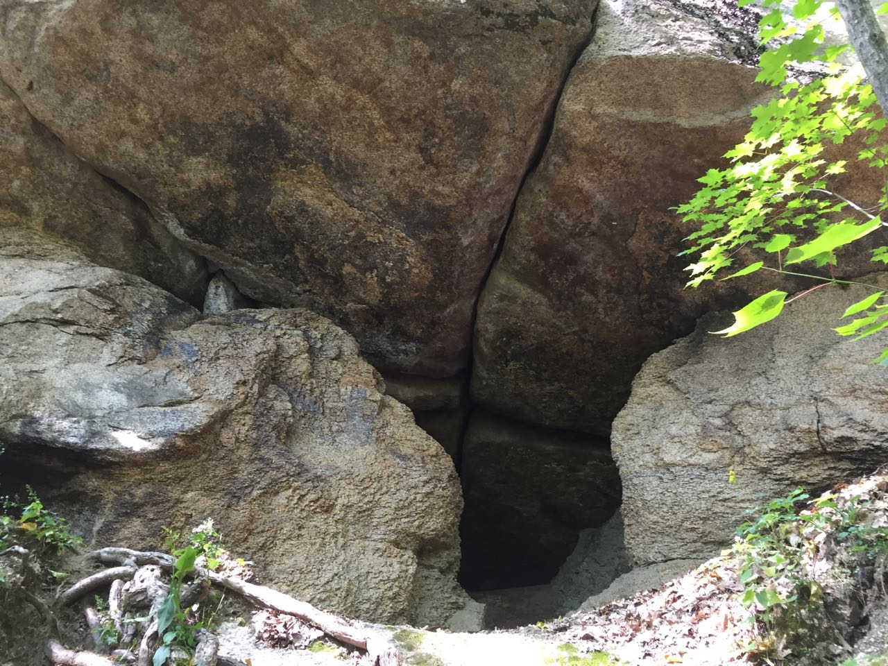
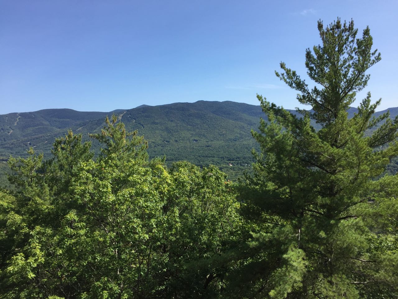
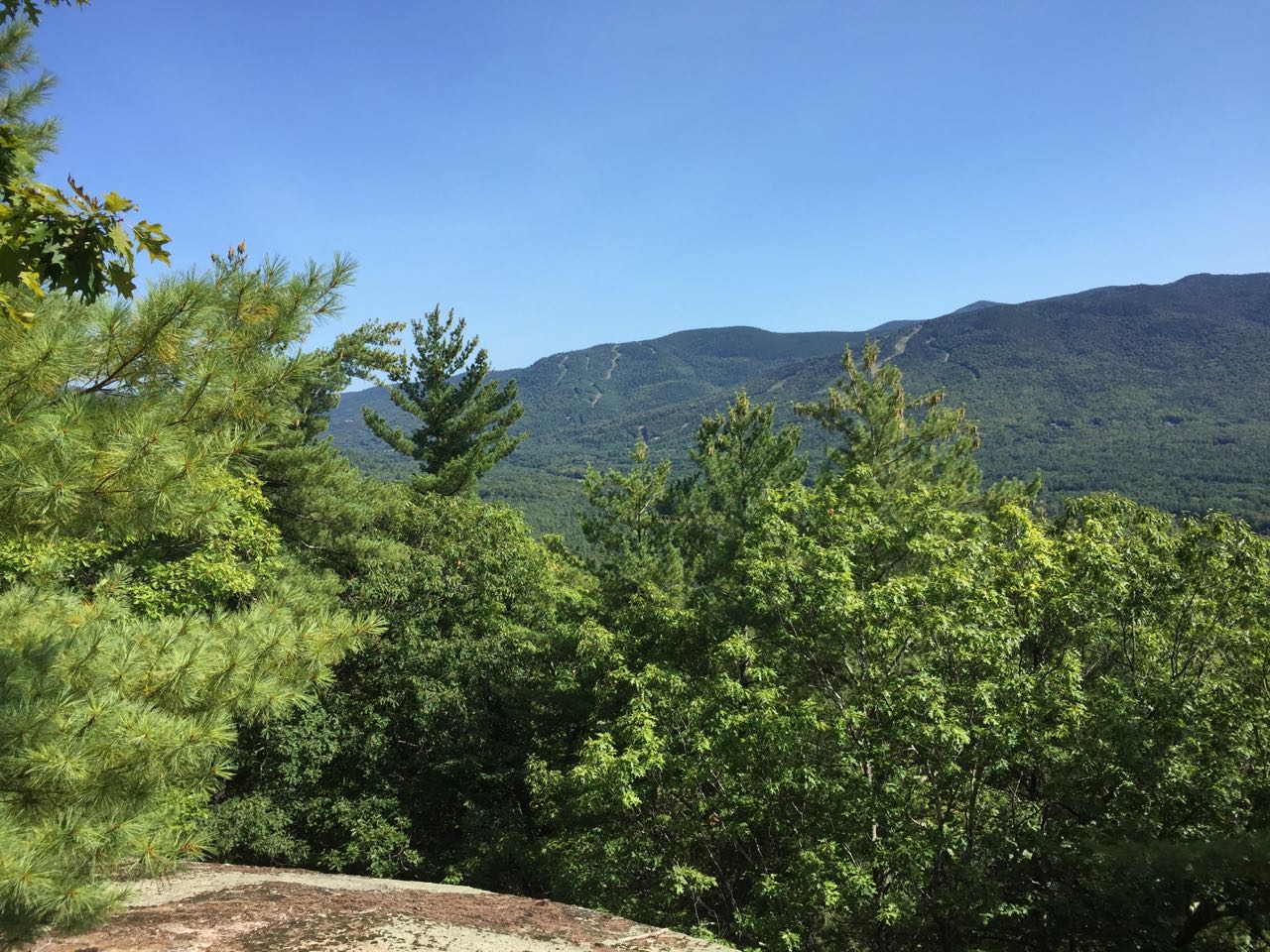
Cave Mountain is a small, low ridge extending from the southern Montalban Ridge, around Oak Ridge, Mt. Parker, and Mt. Langdon. The summit, really not much of its own mountain, is off-trail and has no views to be found. A little-known hiking trail extends up its southern slopes, providing access to the namesake of the mountain, a large and impressive boulder overhang forming a cave in the middle of a steep slope. Just above the cave is a restricted but interesting viewpoint overlooking the ski slopes of Attitash Ski Area.
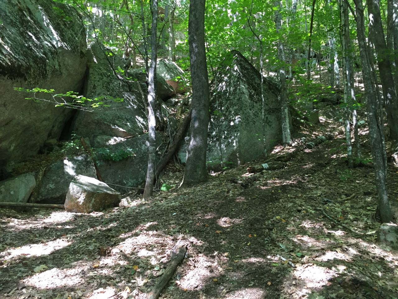
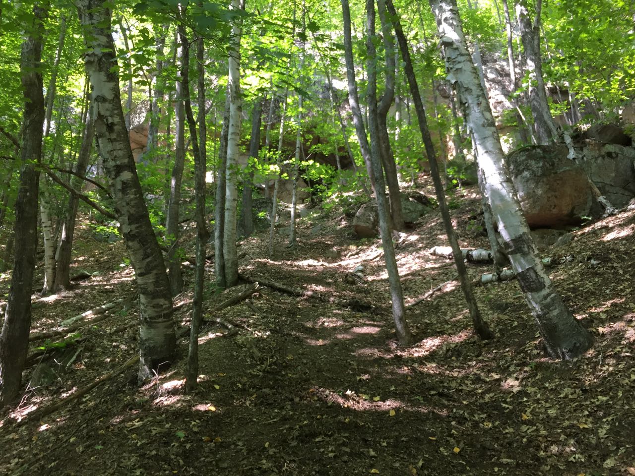
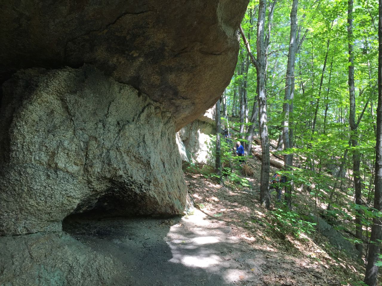
The hike begins on the first section of the Mt. Langdon Trail, most commonly used to access Mt. Parker. Start at the side of the Saco River and head up the Mt. Langdon Trail, following an overgrown logging road through an area of recent logging. Reach a junction not far from the trailhead and continue straight as two other logging roads split off to either side of the main road. In 0.3 miles from the trailhead, a small sign on the left points the way to Cave Mountain. Turn left here and follow the path through the midst of the logged areas, climbing gently at first on a footpath marked with faded blue blazes. The path steepens more and more over the next quarter mile until you leave the logged area. Pass a group of large boulders and swing right, attacking a very sharp, gravelly slope. This is the most difficult section of this short hike. The footing here is very loose and it is adviseable to stay out of the center of the trail and use trees to aid in climbing. With the cave in sight ahead, struggle up the slope until you arrive beneath a huge ledge overhang. Beaten paths lead along the base of the rock wall, where the stone has been severely eroded away. The caves are not very deep, but the scale of the whole formation is impressive. Once you have finished exploring the caves, continue on the trail to the right (facing uphill), which wraps around the back of the ledges, climbing steeply up to the top of the overhang, where you have a view over the treetops to Attitash Mountain and its ski area. The whole serious climb is not more than 0.15 miles.
Printable directions page